
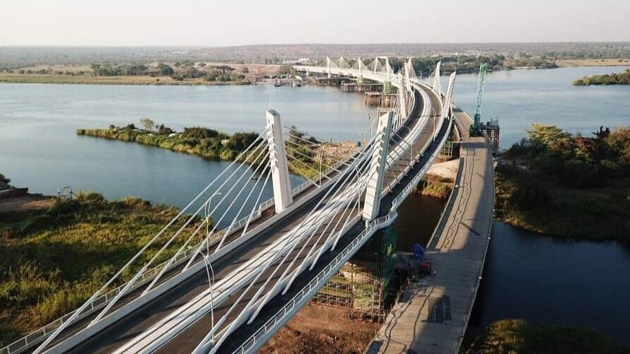

The Kazungula Bridge is more than a road crossing over the Zambezi River. It is an unusual piece of civil engineering built at one of southern Africa's most geographically complicated locations, where Botswana and Zambia meet close to Namibia and Zimbabwe.
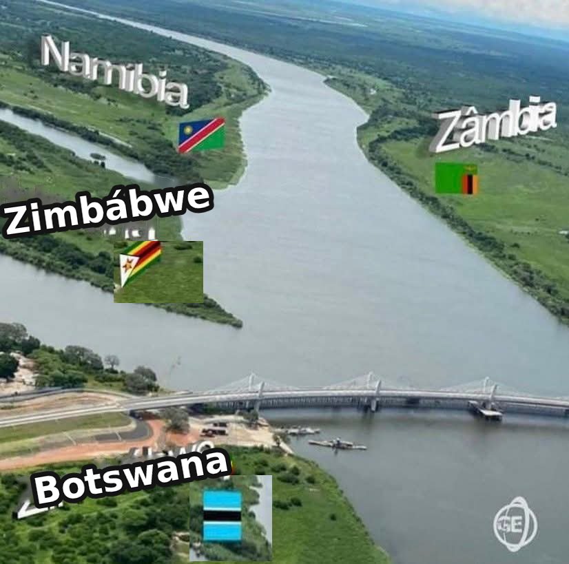
The four countries meeting point. /Ke Rising
The 923-metre bridge connects Kazungula in Botswana with its namesake town in Zambia. It replaced the Kazungula Ferry and opened to traffic in May 2021 after several years of construction.
Its most distinctive engineering feature is its alignment. The bridge does not run in a straight line across the river. It follows a deliberate curve, designed around the exceptionally tight geography of the international boundaries in the area.
Botswana and Zambia share only a short stretch of boundary in the Zambezi River at Kazungula. Zimbabwe and Namibia are also extremely close, creating the unusual geographical configuration commonly described as a quadripoint.
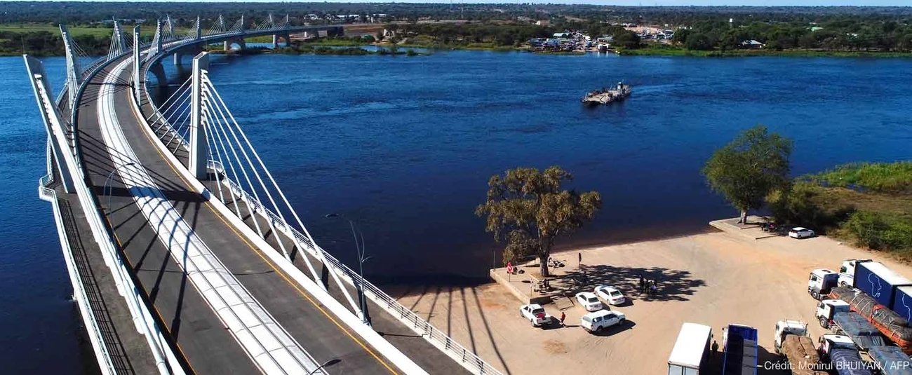
The bridge provides stunning views. /AfDb
That geography presented a practical engineering constraint. The bridge had to connect Zambia and Botswana without crossing into the territory of either neighbouring country. Its curved alignment is therefore not simply an architectural choice. It responds directly to the shape of the border and the river channel.
Structurally, Kazungula is an extradosed bridge, a form that sits between a conventional girder bridge and a cable-stayed bridge. It uses stay cables connected to relatively low pylons to provide additional support to the bridge deck.
The bridge is approximately 18.5 metres wide and has a longest span of 129 metres. Its structure incorporates multiple spans and piers within the Zambezi, allowing the crossing to extend across the wide river and its floodplain.

The bridge when it was under construction. /Deboo Photography
The deck carries a two-lane road, with one lane in each direction, as well as pedestrian walkways. A railway alignment was incorporated into the bridge structure, providing for a future rail connection as part of the proposed Mosetse-Kazungula-Livingstone railway.
That railway provision is one of the project's more interesting features. The bridge was therefore designed not simply as a replacement for the ferry but as part of a wider transport corridor capable of accommodating both road and rail movement.
Building such a structure in a remote river environment also presented logistical challenges. Specialist materials for the stay-cable system had to travel long distances to reach the construction site, with some components transported from Durban through South Africa and Botswana.
DYWIDAG, which supplied the stay-cable materials, says transportation to the remote site was difficult and time-consuming. Cable installation took place between 2018 and 2020, while the main construction was undertaken by South Korean contractor Daewoo Engineering and Construction.

Marvellous. /Visit Chobe
The bridge was part of a wider project that included international border facilities on both sides of the river. The associated one-stop border post was designed to allow Botswana and Zambia to coordinate immigration, customs and other border procedures within an integrated facility.
This was important because the bridge was intended to change how freight moved through Kazungula. Before its construction, trucks and other vehicles depended on ferries to cross the Zambezi, exposing the route to delays associated with ferry capacity and river operations.
The name itself has an interesting local connection. Kazungula is derived from the sausage tree, Kigelia africana, which is known locally as mzungula. The distinctive tree grows in the region and is associated with the origin of the place name.
Kazungula has also been a crossing point for centuries. Long before the modern bridge, people crossed the Zambezi using traditional canoes known as mekoro. The location's importance came from its position near the meeting of the Zambezi and Chobe river systems.
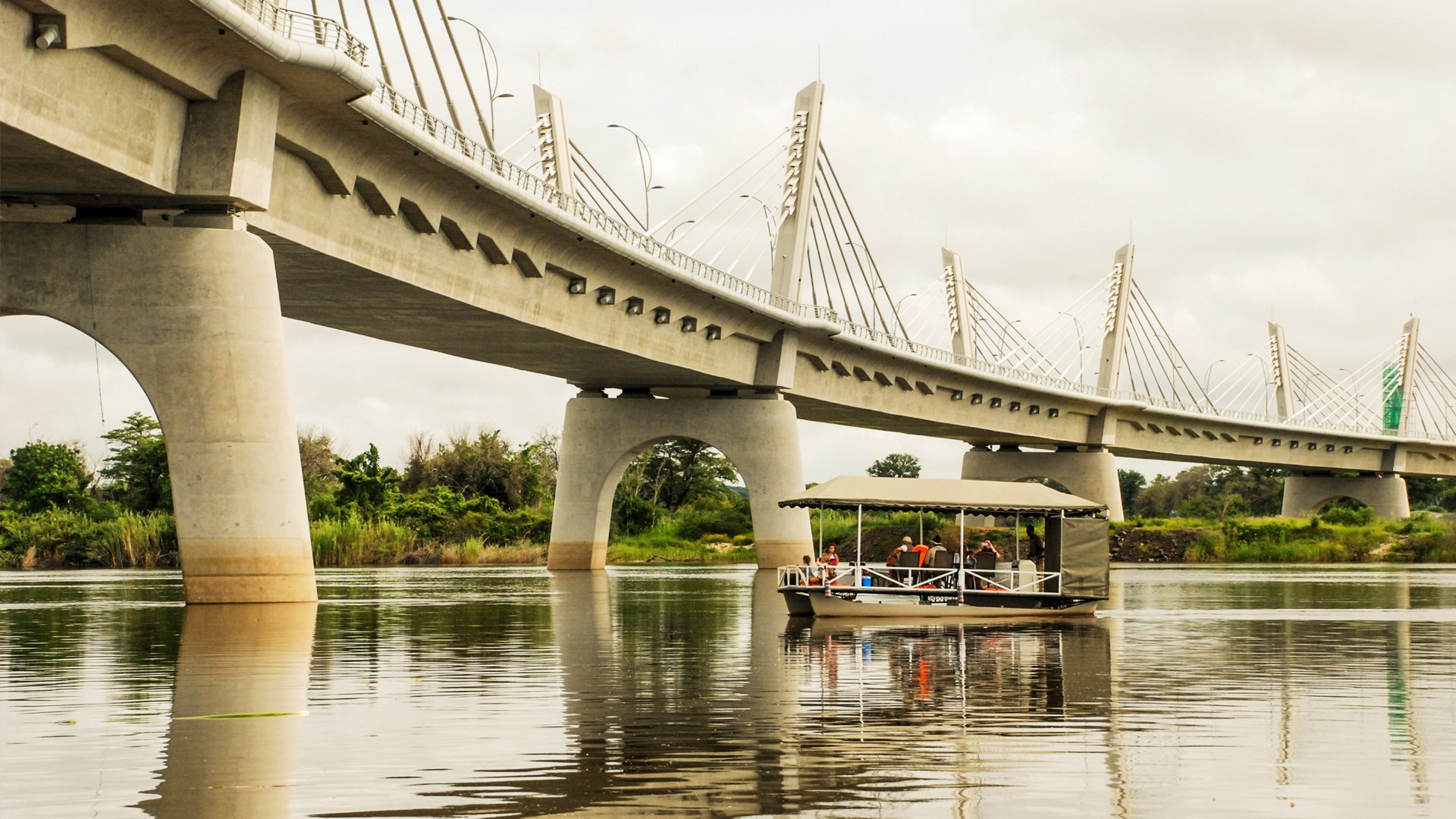
Kituristi. /Visit Chobe
Today, the geography is what makes Kazungula particularly fascinating. The bridge physically links only Zambia and Botswana, but it stands beside one of the world's most unusual international boundary configurations involving four countries.
Strictly speaking, calling Kazungula a perfect four-country quadripoint can be misleading. The countries' territories approach one another around the rivers rather than sharing a conventional four-way land boundary marked by a single point.
That distinction does not diminish the engineering challenge. The bridge had to be positioned within a very constrained international and riverine environment while providing a reliable transport link across the Zambezi.
Kazungula consequently brings together geography, border administration and structural engineering in one project. Its curved deck is a response to the border, its extradosed structure addresses the river crossing, and its transport facilities were designed to support movement through one of southern Africa's important regional corridors.
Comments (0)
Leave a Comment
No comments yet. Be the first to share your thoughts!