
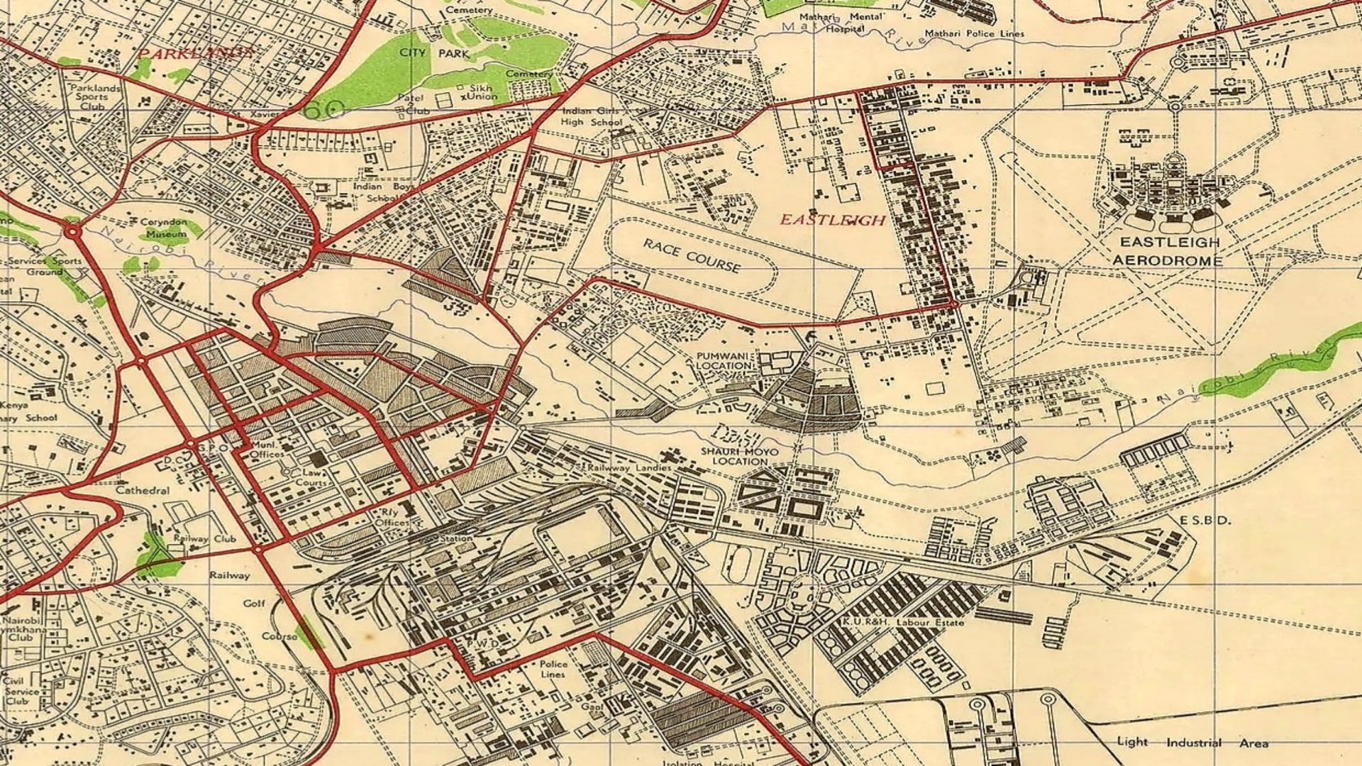

An archival map dating back to 1955 offers a clear view into the early spatial organization, transport networks, and land use patterns of colonial Nairobi.
Originally prepared by the Survey of Kenya (SOK), the zoomed-in historical document highlights how the capital functioned decades before its major modern expansion.
The cartographic records illustrate a vast difference in urban density compared to present-day Nairobi. Areas around Kabete were predominantly covered by agricultural land, functioning mostly as extensive coffee plantations.
The footprint of Kibera appears significantly smaller than its contemporary boundary, reflecting early settlement patterns under colonial administration.
Key public institutions and healthcare facilities are clearly marked on the vintage plan. Mathari Mental Hospital is situated on the map, along with established recreational and public infrastructure sites including the original city racecourse.
Transport corridors, principal roads, rail lines, and designated footpaths show the core connectivity that linked the urban center to its surrounding agricultural periphery.
The spatial layout also captures residential distribution patterns of the era, marking specific zones where Indian populations settled alongside local African housing locations such as Pumwani, Shauri Moyo, and the Kenya Uganda Railways and Harbours (KUR&H) Labour Estate.
Military and aviation infrastructure is similarly prominent, featuring the Eastleigh Aerodrome, which later became the Moi Air Base.
Engineers and urban planners frequently examine mid-century maps to understand underlying drainage, land allocation history, and utility corridors.
Historic urban boundaries mapped during this period continue to influence contemporary rights-of-way and metropolitan infrastructure projects across the capital.
Comments (0)
Leave a Comment
No comments yet. Be the first to share your thoughts!