
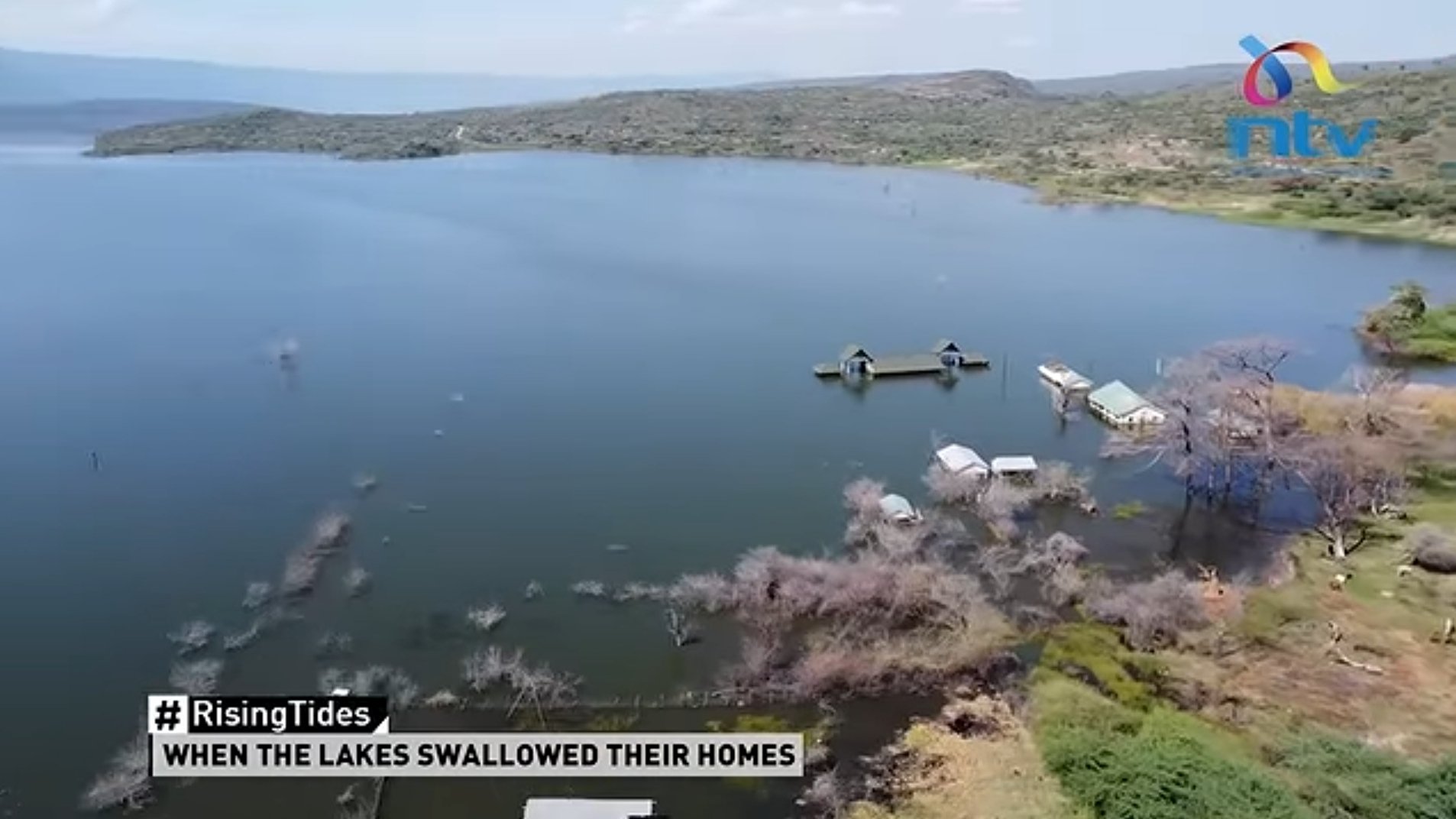

Rising water levels in the Kenyan Rift Valley have pushed Lake Baringo and Lake Bogoria closer toward potential convergence, prompting technical monitoring and intense debate over civil engineering interventions.
According to reporting by NTV Kenya, expanding lake boundaries have inundated residential homesteads, submerged agricultural farmland and destroyed critical road infrastructure across several villages in Baringo County.
For generations, communities depended on the fertile land surrounding the lakes. That land now lies in ruins, swallowed by the advancing waters, leaving only scattered structures and trees rising from the surface where homes and farms once stood.
Technical data shared by Dr. Eng. John Mativo shows the Loboi Sill near Loboi village stands at 1,000.7 meters above sea level, marking the highest point of the natural drainage divide.
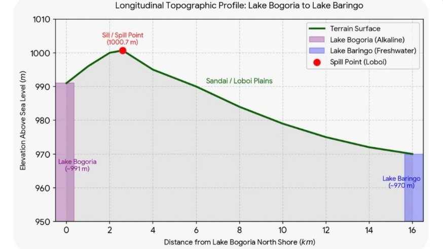
The elevation differences. /Dr. Mativo on X
Because Lake Bogoria lies approximately ten meters lower than this critical spill point, hydrologists are closely monitoring water elevations to assess whether surface overflow into adjacent drainage basins is imminent.
The two water bodies possess starkly different ecological characteristics. Lake Baringo is a freshwater lake supporting vital fish stocks, while Lake Bogoria is an alkaline water body known for hot springs and flamingos.

Lake Baringo and Lake Bogoria. /Google Maps
Local administrators warn that any physical merging of the lakes would alter water chemistry, putting freshwater fish populations at risk and damaging tourism infrastructure built around Lake Bogoria National Reserve.
Hydrological pressures are also manifesting underground. In Mogotio constituency, subterranean water seeping to the surface flooded more than 250 acres of agricultural land and threatened dozens of residential structures.
Geological experts attribute rising lake levels to a combination of increased seasonal rainfall, severe catchment siltation and tectonic fault lines that channel groundwater movement throughout the Rift Valley region.
To mitigate the threat, environmental researcher Professor Simon Onywere has proposed altering river discharge patterns, suggesting that certain river flows, including the Waseges, be redirected into Lake Baringo rather than Lake Bogoria.

Prof. Onywere. /NTV
Under this intervention plan, excess water from Lake Baringo would be channelled toward the low-lying Suguta Valley through a regulated structure near Loruk, providing water for agricultural irrigation.
Onywere emphasises that catchment management must take priority, calling for soil conservation practices that increase rainwater infiltration into the water table rather than allowing heavy silt and surface runoff to enter lakes.
Commercial operations along the shorelines face severe disruption. Resort facilities, administrative outposts and main access gates at Lake Bogoria currently sit submerged, forcing operators to abandon established tourism sites.
Over 600 households face displacement or loss of income as shifting shorelines swallow pasture land, leaving displaced residents dependent on casual labour while waiting for governmental adaptation plans.
Local leaders are calling on the national government and international development partners to fund comprehensive hydrological mapping, catchment restoration and structured drainage systems across the lake basin.
Meanwhile, institutions including the Water Resources Authority are expected to conduct subsurface drilling to test groundwater salinity and determine if subterranean mixing between the freshwater and saline aquifers has occurred.
Comments (0)
Leave a Comment
No comments yet. Be the first to share your thoughts!