
A version of this article appeared on LinkedIn by James Murithi.
Many stormwater design drawings look impressive on digital screens, but they frequently fail on-site constructability evaluations. Infrastructure projects across Kenya and the globe require meticulous alignment between digital drafting and physical site realities, if engineers want to prevent expensive revisions during active field excavation.
Infrastructure failure often stems from a massive disconnect between automated design software and physical constraints on the ground. Experienced engineers emphasize that rushing into complex three-dimensional modeling without basic spatial validation creates severe errors, which eventually manifest as deep structural flaws.
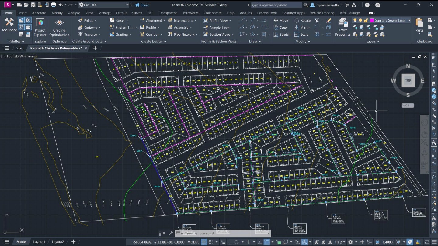
As highlighted by engineering trainer James Murithi in technical presentation, designers must check specific parameters before modeling pipe networks. A common error involves ignoring basic layout restrictions within standard Computer-Aided Design (CAD) applications before generating full networks.
Engineers frequently jump straight into advanced hydraulic piping modules within specialized software like Autodesk Civil 3D. However, doing so without a rudimentary spatial roadmap leads to unconstructable pipe networks, which clash directly with existing subterranean utilities or violate critical gravity-flow drainage gradients.
To prevent these costly digital drafting errors, professionals recommend initiating the entire network design process with simple polylines. Sketching the initial alignment manually using these simple lines allows designers to map out the general layout, but without committing to complex structural database definitions.
These basic polylines serve as a highly flexible drafting guide, allowing for rapid adjustments to the proposed pipe paths. By plotting preliminary paths directly over detailed topographical surveys, civil engineers can easily visualize potential physical obstructions, although these are easily missed in automated systems.
This preliminary sketching phase acts as a critical filter, catching fundamental layout flaws before they become embedded in the final design. It ensures that the horizontal alignment strictly conforms to physical site boundaries, which is particularly vital in congested urban centers like Nairobi.
Once the preliminary polyline layout satisfies basic constructability parameters, the formal pipe network modeling can safely begin. The engineering software can then seamlessly convert these basic geometric paths into intelligent, three-dimensional infrastructure objects, when the designer inputs the exact required physical elevations.
Neglecting this initial step typically means that any subsequent complex modeling inherits hidden spatial conflicts. When the completed design finally goes to the field, contractors quickly discover that the proposed pipe invert levels conflict directly with actual underground site conditions, but by then it is too late.
Fixing these severe design discrepancies during the active construction phase heavily inflates municipal project budgets. Redesigning an entire urban stormwater drainage system mid-way through excavation disrupts local traffic, and wastes valuable engineering resources, although a simple polyline check could have avoided the entire crisis.
A successful stormwater network always requires a delicate balance of hydraulic performance capacity and practical physical constructability. Engineers must develop systems that not only handle peak rainfall volumes during heavy storms, but can also be safely, and efficiently installed by local field construction crews.
Furthermore, the transition from basic drafting lines to fully realized three-dimensional pipes requires strict adherence to local civil engineering standards. If the initial paths are flawed, the automated hydraulic calculations generated by advanced design platforms will also become entirely inaccurate for the site.
Adopting this staged drafting workflow ensures that modern digital precision perfectly matches the harsh realities of real-world construction limits. Starting with basic CAD polylines remains an essential best practice for infrastructure development, ensuring that onscreen models translate flawlessly to the ground without errors.
Comments (0)
Leave a Comment
No comments yet. Be the first to share your thoughts!