
The Kenya Meteorological Department has issued a formal high-flood-risk alert for residents living within the Tana River Basin. The warning follows sustained heavy rainfall in the catchment areas, which has significantly increased the volume of water flowing downstream.
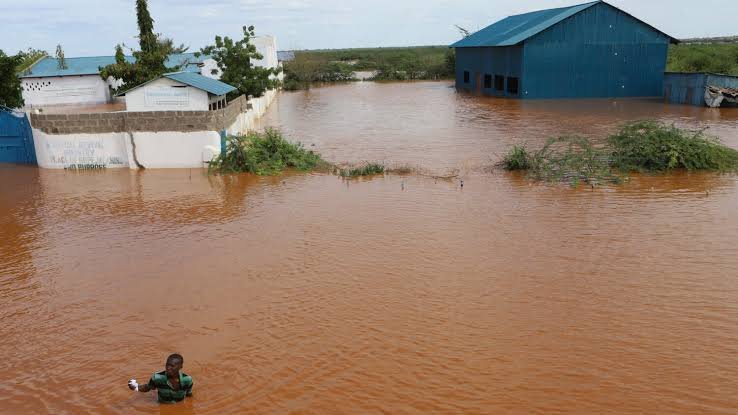
According to the department, the risk is particularly high for populations in Garissa and Tana River counties. These areas are historically prone to severe flooding when the river bursts its banks, often leading to the displacement of thousands and the destruction of essential infrastructure.
Local authorities are now coordinating with emergency services to monitor water levels. Residents in low-lying areas have been advised to relocate to safer, higher ground immediately to avoid being cut off by rising waters.
The Tana River is the longest river in Kenya, playing a vital role in both agriculture and hydroelectric power generation. However, during periods of intense rainfall, its vast drainage basin can funnel immense amounts of water toward the coast, overwhelming traditional drainage systems.
For the construction and infrastructure sector, such alerts are critical. Flooding in this region frequently damages road networks, bridges, and ongoing irrigation projects. Maintenance crews and contractors working on regional developments have been put on notice to secure equipment and materials.
Heavy siltation remains a concern for engineers managing the river’s dams. Excess runoff often carries large amounts of debris and sediment, which can impact the efficiency of power stations and irrigation intake points further downstream.
The Kenya Meteorological Department noted that the current weather patterns are part of a wider seasonal trend affecting much of East Africa. In past years, similar alerts have preceded major logistical disruptions, including the closure of the main highway connecting Nairobi to Garissa.
Government agencies, including the Kenya Red Cross, are reportedly on standby. They are preparing to provide humanitarian assistance should the flooding cause residential displacements or food insecurity in the agricultural belts along the river.
Urban centers within the basin are also at risk. Poorly maintained drainage in growing towns can lead to flash flooding, which undermines building foundations and complicates the delivery of clean water and sanitation services.
President Ruto has previously emphasized the need for better climate resilience and infrastructure planning to mitigate these recurring natural disasters. The government is currently looking at long-term solutions, including the construction of more dykes and water pans to manage overflow.
As the rains persist, the meteorological department will continue to provide daily updates. Officials have urged the public to remain vigilant and avoid attempting to cross flooded roads or seasonal riverbeds, which can become lethal within minutes of a heavy downpour.
Engineers and planners are also being encouraged to factor these rising risks into future project designs. Building for resilience is no longer an option but a necessity in the Tana River region, where the cycle of drought and flood is becoming more volatile.
Comments (0)
Leave a Comment
No comments yet. Be the first to share your thoughts!