

Logging While Drilling (LWD) and Measurement While Drilling (MWD) tools rank among the most complex equipment in modern drilling. They operate in conditions that destroy most machinery yet must deliver precise data and steering control in real time.
At depths around 12,000 feet pressure often exceeds 15,000 psi while temperatures reach 120 to 150 degrees Celsius. The tools sit inside the bottom hole assembly just above the drill bit and face hot drilling mud loaded with rock cuttings, sand and grit.
Everything is under constant abrasion and mechanical shock. The environment is extremely aggressive for any man made equipment. MWD focuses on the well path and supplies inclination, azimuth and toolface data so drillers can steer the bit along a planned 3D trajectory.
This capability is essential for deviated and horizontal wells that must follow specific geological targets rather than simply going straight down.
Downhole tool compenents /Object Zero
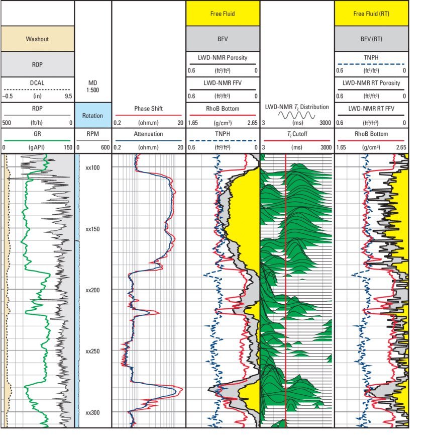
LWD handles formation evaluation with sensors that measure porosity, density and resistivity while also recording natural gamma radiation and nuclear magnetic resonance responses.
Data /Object Zero
The data streams to surface while drilling continues so geologists and directional drillers can adjust the well path on the fly. This helps them stay in the best reservoir zones. The tools themselves are expensive with individual strings that can run into millions of dollars and daily rental rates that often sit between 50,000 and 100,000 dollars.
On a complex well that already costs 100 million dollars the spend is considered necessary because it reduces sidetracks and improves placement. The investment pays for itself quickly. When tools fail the string is sometimes abandoned, cemented in place and the well is then sidetracked around the lost equipment.
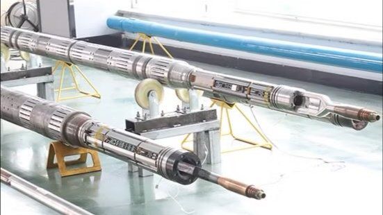
The housings are built from exotic high strength steel grades and contain tightly packed electronics, batteries and sensors. Telemetry systems must survive the downhole conditions. Workshop photographs show long cylindrical sections of these tools where exposed circuit boards and sensor packages become visible once outer protective collars are removed.
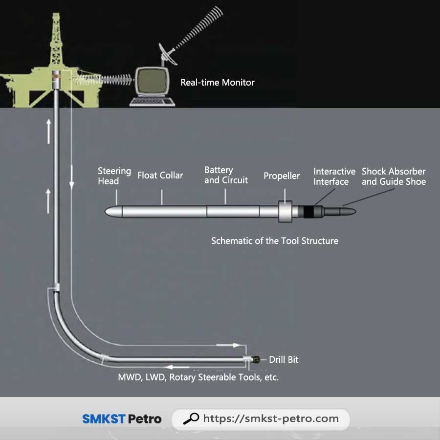
A typical schematic of the bottom hole assembly illustrates integration of steering head, battery section and rotary steerable components just behind the drill bit with real time surface monitors displaying the data. One specialised sensor is the prompt gamma probe that fires neutrons into the formation and analyses returning gamma rays to identify elemental composition and rock types.
Fishing tools form another key part of the ecosystem as they are purpose built to retrieve stuck pipe or broken equipment from the wellbore. Engineers design overshots, spears and jars for recovery operations. The precision these systems deliver shows up beyond oil and gas.
One case used directional drilling from surface to hit a flooded mine tunnel 435 metres below with accuracy that reached within a few centimetres. Cameras and remotely operated vehicles went through the hole before concrete sealed the tunnel and the mine was later dewatered successfully. In Kenya similar technologies have supported oil exploration in wells drilled in the Lokichar Basin, Turkana County.
MWD provided directional control while LWD suites delivered real time formation evaluation in sandstone reservoirs. Geothermal drilling in the Rift Valley also relies on these tools for high temperature wells at Olkaria and Menengai that require equipment rated for harsh conditions. Directional methods target productive fracture zones effectively.
As Kenya expands its energy programmes local engineers gain hands on experience. Service contractors train technicians in these specialised drilling technologies so domestic capacity continues to grow steadily.
Comments (0)
Leave a Comment
No comments yet. Be the first to share your thoughts!