
Even as political delegations from China and Vietnam seek to improve bilateral ties through formal diplomatic channels, technical surveillance paint a far more volatile picture on the water.
Newly analyzed satellite images and ship-tracking data show that the risk of a physical clash is quietly rising across contested corridors of the South China Sea.
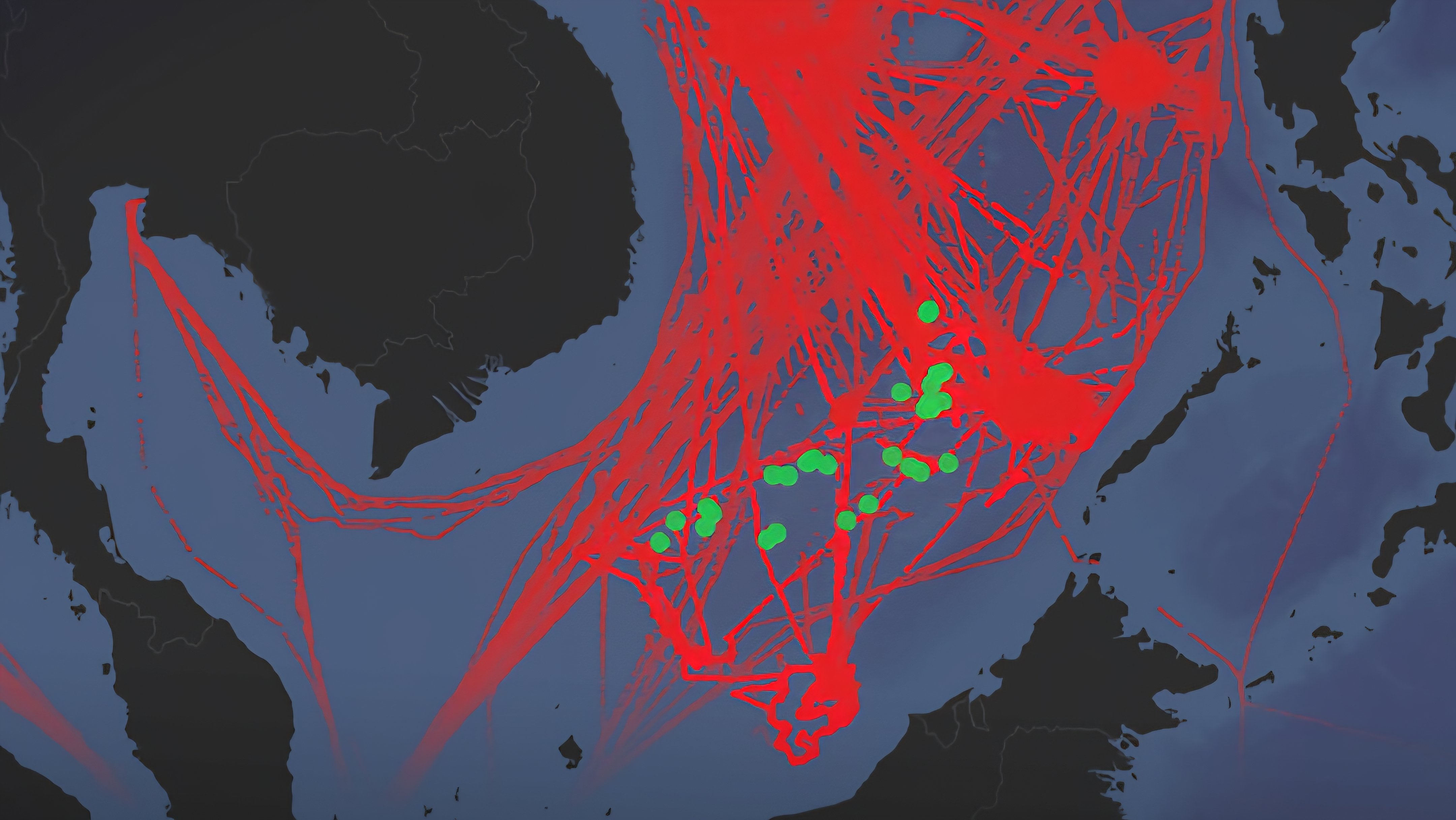
The maritime tracking records a dense matrix of overlapping deployments, where state-backed vessels frequently navigate close to one another in highly sensitive waters. This operational friction continues to outpace the diplomatic rhetoric projected by both governments during formal state visits.
The underlying data maps out extensive grids of Chinese maritime fleet activity weaving directly adjacent to outposts currently occupied by Vietnamese forces. This persistent, close-quarters maneuvering narrows the margin for error on the high seas, significantly elevating the probability of a localized miscalculation.
Independent maritime analysts tracking the region note that the friction is concentrated along critical international trade infrastructure corridors, where unregulated traffic and competing territorial claims intersect.
The continuous deployment of heavy maritime law enforcement fleets alongside localized fishing groups makes these specific waters a prominent global flashpoint.
The published data underscores a substantial disconnect between official foreign policy statements and the reality of state-backed maritime maneuvers.
As both nations continue to expand their strategic footprints and reinforce their respective positions, the possibility of a sudden naval or coast guard confrontation remains a critical vulnerability for regional stability.
Comments (0)
Leave a Comment
No comments yet. Be the first to share your thoughts!