
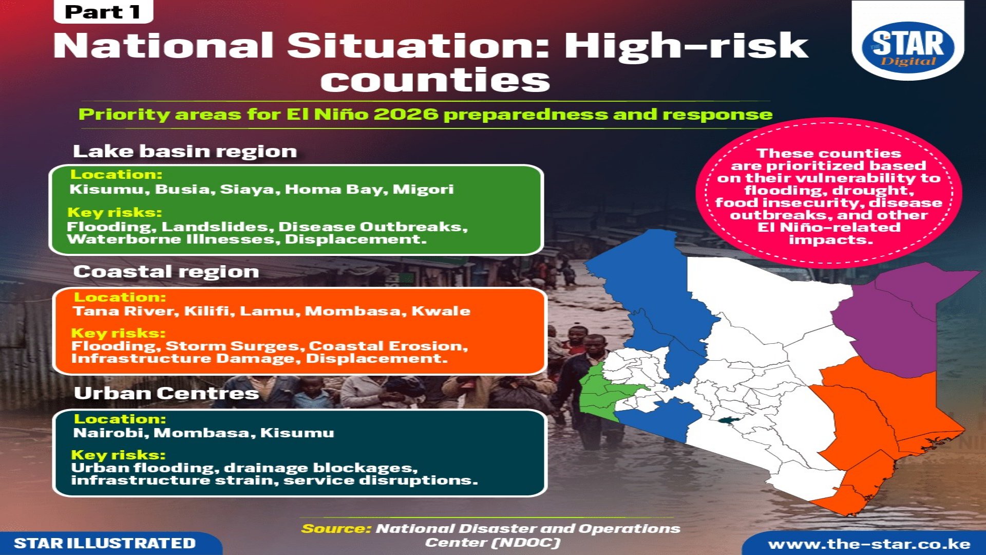

The National Disaster Operations Centre (NDOC) has identified several high-risk counties across Kenya that will require priority attention as the country prepares for El Niño conditions in 2026.
Official assessment data published by the state agency highlights key regions vulnerable to flooding, drought, food insecurity, disease outbreaks, and related operational impacts.
Priority zones are mapped out based on specific regional threats, with infrastructure strain, displacement, and environmental damage expected across multiple sectors.
State monitoring shows that different geographical areas face distinct hazards during the upcoming weather pattern.
The Lake Basin region, which includes Kisumu, Busia, Siaya, Homa Bay, and Migori, faces severe primary risks. Authorities listed key threats for these western counties:
* Flooding
* Landslides
* Disease Outbreaks
* Waterborne Illnesses
* Displacement
In the Coastal region, covering Tana River, Kilifi, Lamu, Mombasa, and Kwale, official mapping points to heavy structural hazards. Disaster response planners recorded key risks for these maritime areas:
* Flooding
* Storm Surges
* Coastal Erosion
* Infrastructure Damage
* Displacement
Major urban centres, specifically Nairobi, Mombasa, and Kisumu, are projected to face acute municipal pressure under heavy rainfall. The assessment identifies critical threats to city utilities:
* Urban flooding
* Drainage blockages
* Infrastructure strain
* Service disruptions
In the Rift Valley region, encompassing Turkana, Baringo, West Pokot, and Narok, environmental and agricultural threats remain dominant. Identified hazards include:
* Drought
* Floods
* Landslides
* Livestock losses
* Food insecurity
Across the North Eastern region, including Garissa, Wajir, and Mandera, disaster mapping highlights severe resource stress. Key risks noted by the government include:
* Drought
* Water scarcity
* Livestock losses
* Poor pasture
* Food insecurity
Disaster authorities continue to emphasize early intervention for prioritized locations, where severe disruptions to daily services and physical assets are anticipated. Local emergency response teams are monitoring conditions closely across all flagged zones.
Comments (0)
Leave a Comment
No comments yet. Be the first to share your thoughts!