
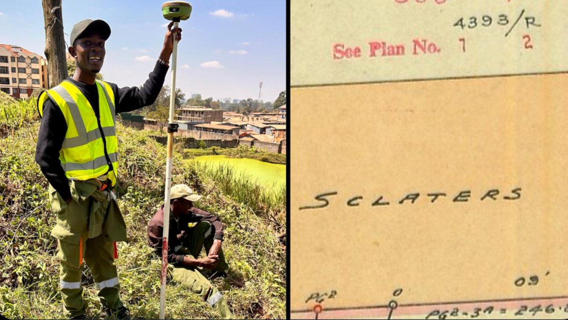

A Kenyan land surveyor working in the field uncovered a 1952 survey map that labels what is now modern Waiyaki Way as Sclater's Road, illustrating how current infrastructure correlates directly with historic transport routes.
The discovery highlights an interesting aspect of professional land surveying, where practitioners frequently retrace historical records alongside physical boundaries. Modern spatial measurements often rely on legacy archival plans to establish clear legal rights and spatial continuity.
Sclater's Road was originally constructed in the late nineteenth century as an ox-cart track connecting Kibwezi to Busia. The historical route played a foundational role in establishing early colonial trade corridors prior to the construction of the Uganda Railway.
Over the decades, the historic corridor underwent significant structural redesigns to accommodate rising vehicular traffic across the capital city. The road was eventually renamed Waiyaki Way to honor the nineteenth-century Kikuyu chieftain Paramount Chief Waiyaki wa Hinga.
Today, the major thoroughfare forms a crucial section of the A104 highway managed under the Kenya National Highways Authority (KeNHA). The arterial corridor connects the Central Business District (CBD) to the western suburbs and major regional transit links.
Land surveying professional practice relies on historical survey plans archived at the Survey of Kenya (SOK). Practitioners regularly review vintage cadastral maps to resolve modern boundary disputes and verify original property alignments.
Archival maps compiled during the colonial era remain legally binding reference documents across local registry offices. Contemporary Global Navigation Satellite System (GNSS) instruments are routinely calibrated against these historic boundary markers to maintain spatial accuracy.
The 1952 cadastral plan illustrates the spatial transformation of Nairobi over the past seven decades. The document confirms that modern highway alignments continue to mirror early infrastructural frameworks established over a century ago.
Retracing historical survey records offers valuable context for urban planners and civil engineers working on infrastructure expansions. Historic easements and road reserves continue to dictate modern right-of-way boundaries across Kenya.
Comments (0)
Leave a Comment
No comments yet. Be the first to share your thoughts!