
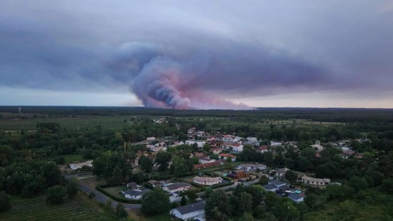

Tens of thousands of people have been evacuated from the surrounding region of Gironde near Bordeaux, as emergency services battle wildfires fueled by extreme atmospheric conditions.
Intense heat from the blazes has generated a pyrocumulonimbus, a severe fire-spawned thundercloud capable of creating its own localized weather systems.
The phenomenon occurs when extreme surface heat forces vast plumes of hot air, smoke, and moisture rapidly into the upper atmosphere. As the rising column cools, condensed water vapor forms giant clouds that can generate lightning strikes and erratic wind downdrafts.
National Aeronautics and Space Administration (NASA) scientists often refer to the dangerous clouds as the fire-breathing dragon of clouds.
Firefighters in southwestern France face severe operational hurdles as the storm systems alter local conditions on the ground. High-altitude downdrafts can drive embers far ahead of the main fire front, starting fresh blazes and shifting direction without warning.
The dynamic shifts complicate containment efforts and make direct ground access dangerous for fire crews.
Regional authorities have prioritized widespread civilian evacuations to prevent casualties across vulnerable rural and suburban zones.
Transport infrastructure and local utility networks remain under stress, while authorities monitor smoke columns and wind shifts across Gironde.
Similar fire-generated cloud formations have historically caused severe disruption during extreme drought and heat events in Australia and North America.
Meteorologists note that such systems require exceptionally high thermal output to form, making them a clear indicator of unusually aggressive wildfire behavior.
Emergency teams continue to monitor atmospheric stability and temperature forecasts across the region. Containment strategies rely heavily on weather shifts, as ground crews adapt to unpredictable wind conditions triggered by the persistent heat columns overhead.
Comments (0)
Leave a Comment
No comments yet. Be the first to share your thoughts!